LINE OF SIGHT SURVEYS
LINE OF SIGHT SURVEYS
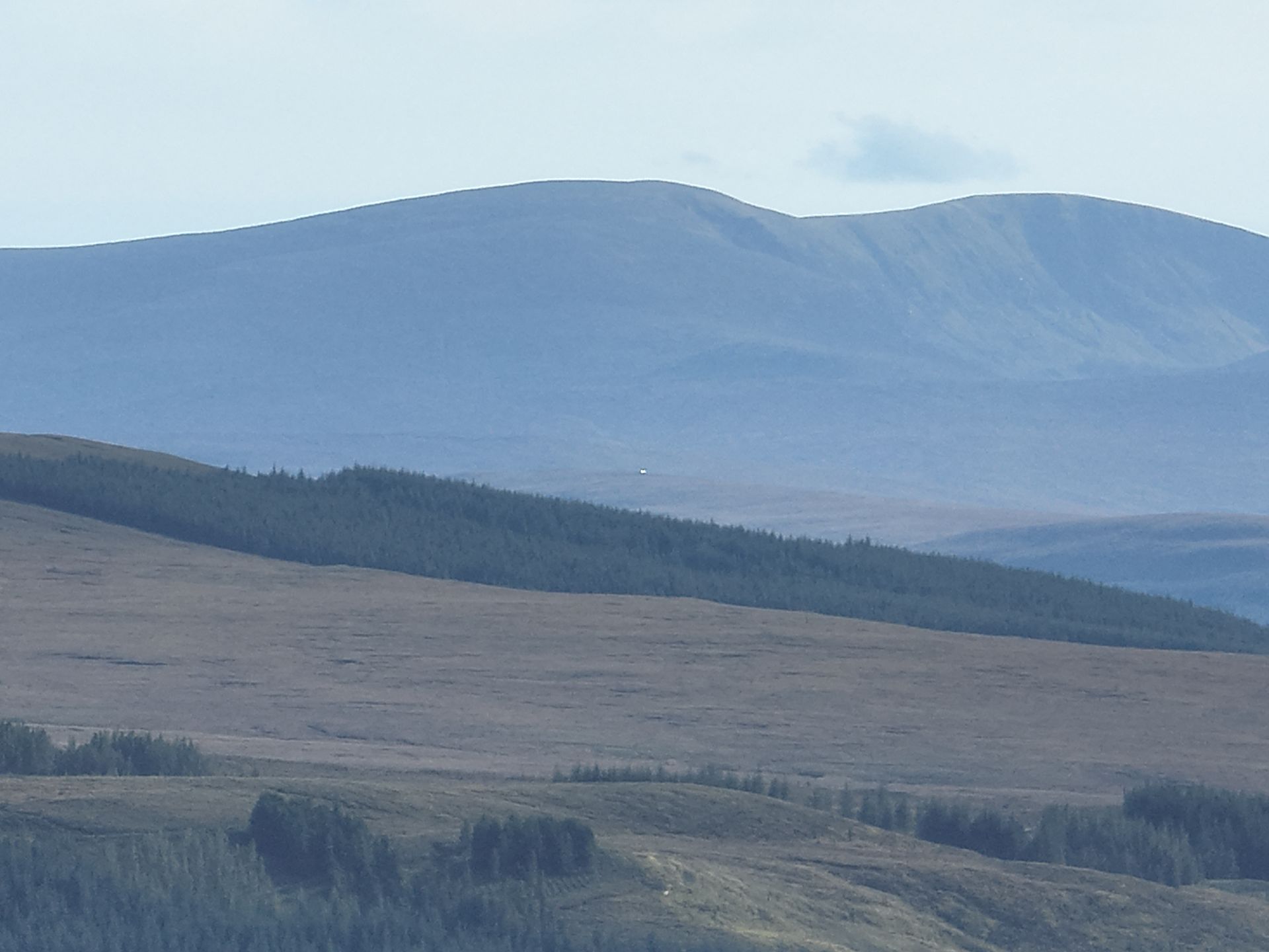
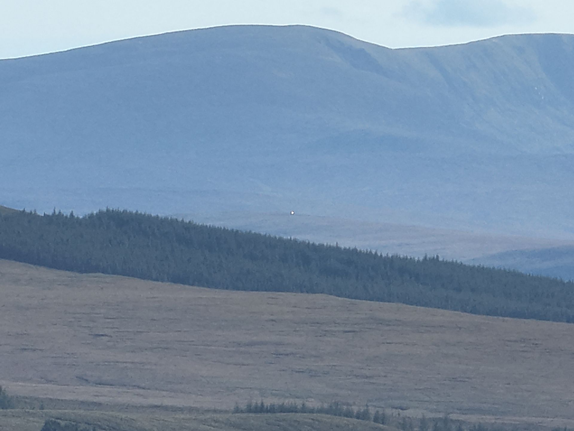
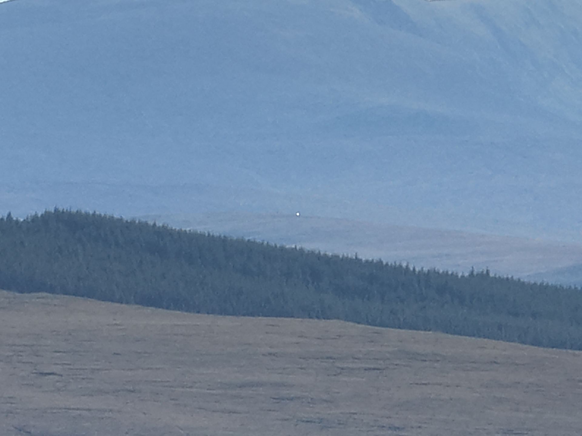
We specialize in precise Line of Sight (LOS) surveys using cutting-edge drone technology. Our expert team ensures accurate evaluations to determine the feasibility of clear sightlines for telecommunications, infrastructure projects, and other critical applications.
We use advanced pre-planning tools to analyze locations and identify potential obstructions before deployment. Using state-of-the-art drone technology, our two commercial drone pilots operate two high-performance drones equipped with powerful zoom cameras and bright lights, allowing us to capture detailed imagery even in challenging conditions.
We identify, photograph, and assess trees, buildings, or other obstacles that may interfere with the line of sight. The grazing point is carefully analyzed to determine the lowest clearance along the path, ensuring an unobstructed view.
With our expertise and cutting-edge equipment, we deliver precise and reliable data to support your project’s success.